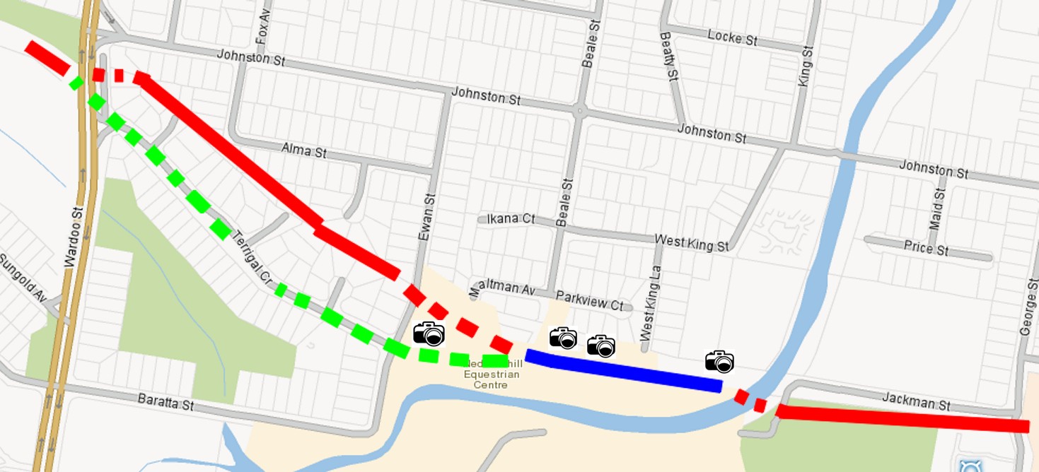
Jackman St to Wardoo St
This part of the trip is slightly vague, but at Wardoo St the line is still very obvious.
Go Back <-> To Next Page
 Looking west from the Creek end of the Blue Line (right camera icon on map) May 2013
 Looking east from around the middle of the blue line (2nd most right camera icon on map) May 2013
Note the drop off to right, both sides of the path show it is artificially raised
 The pathway ends on the western end with a concrete entrance (2nd camera icon from left on map) May 2013
Looking east in photo
 Same place as the photo above but looking west
Looking west in photo
 The path out to Ewan Street has just slight level in it (left most camera icon from on map) May 2013
Looking east in photo
Confusing Paths:
The Zig Zag in the bottom of Jackman Street probably indicates where the line crossed the road as it headed over the creek. I've coloured the route blue after here as much of the path is still visible in this section.
At the end of the blue section the line runs out into a flat parkland area and then there is no clear indication where it went.
The Next bit of Red is the obvious path by the street layout but it is also a floodway which doesn't make sense unless the track ran along the bank.
The Green line is an alternative path and Terrigal Cr does seem to be unusally wide and the smoother contour than expected makes it likely this is the old path.
2013 update - found a topographic map from 1966 - the line did run beside the floodway
Larger Map
Topographic Map
Continue the journey with NEXT on the left or below.
Designed by WebTemplatePortal.com
This template is under the Creative Commons Attribution 2.5 License.