Southport to Helensvale
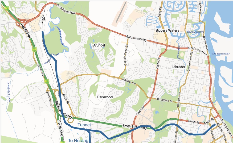
The approximate route of the old line is shown on the map as the Blue Line. Follow the journey using the “Next” link on each page, or jump straight to the Site Map to skip to a particular page.
Approximate path: the Southport end of the line starts under the Southport Transit Station; the old turntable for the engine to turn around was roughly in the garden at the back of the building. The line then ran up to the corner of High Street and Nind Street, around the back of St Hilda’s School, down to the edge of Owen Park then across the creek and over Ewan Street to run in a dogleg across Wardoo Street.
From Wardoo Street the old track is now a walkway to Griffith University, passing Woomera Crescent, then crosses Smith Street very close to where the light rail bridge now goes over. It ran parallel to the road until crossing back south of Smith Street at the Olsen Ave Interchange.
From there it runs around the back of the Molendinar factory estate, across Ashmore Road/Activity Crescent and eventually to the old Ernest Junction Station, which was approximately between Export Drive and Ashmore Road. A fork in the line then ran south to Nerang.
Just past this station is the old tunnel, from where the line ran west to the Smith Street/M1 interchange area and then roughly paralleled the new line to Brisbane Road. The line then also roughly followed the new line to Coombabah Creek, where it crossed onto the edge of the Gold Coast Country Club and down to the approximate area of the new Helensvale Station.